
McAfee Knob Day Hike Along the Appalachian Trail
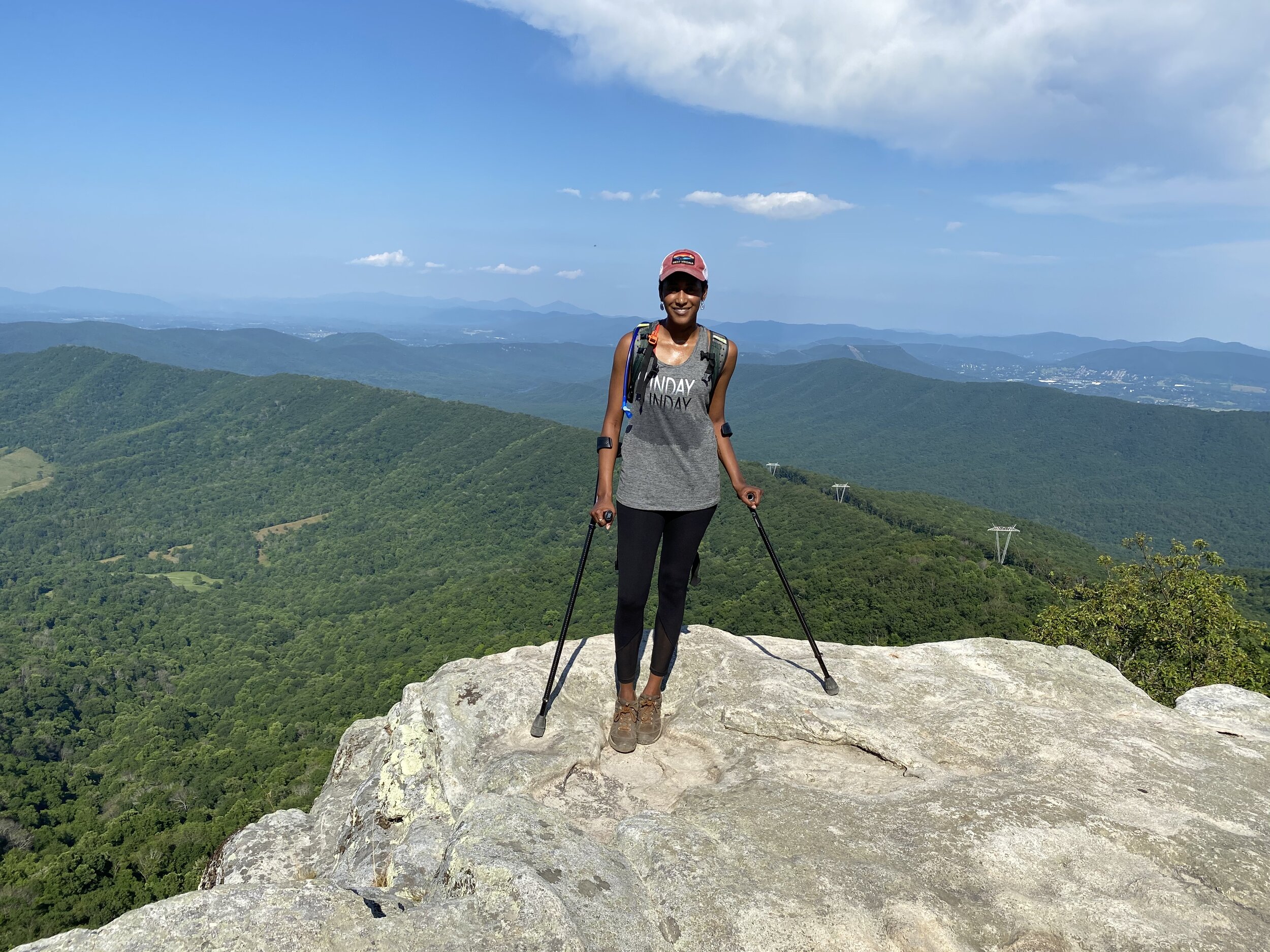
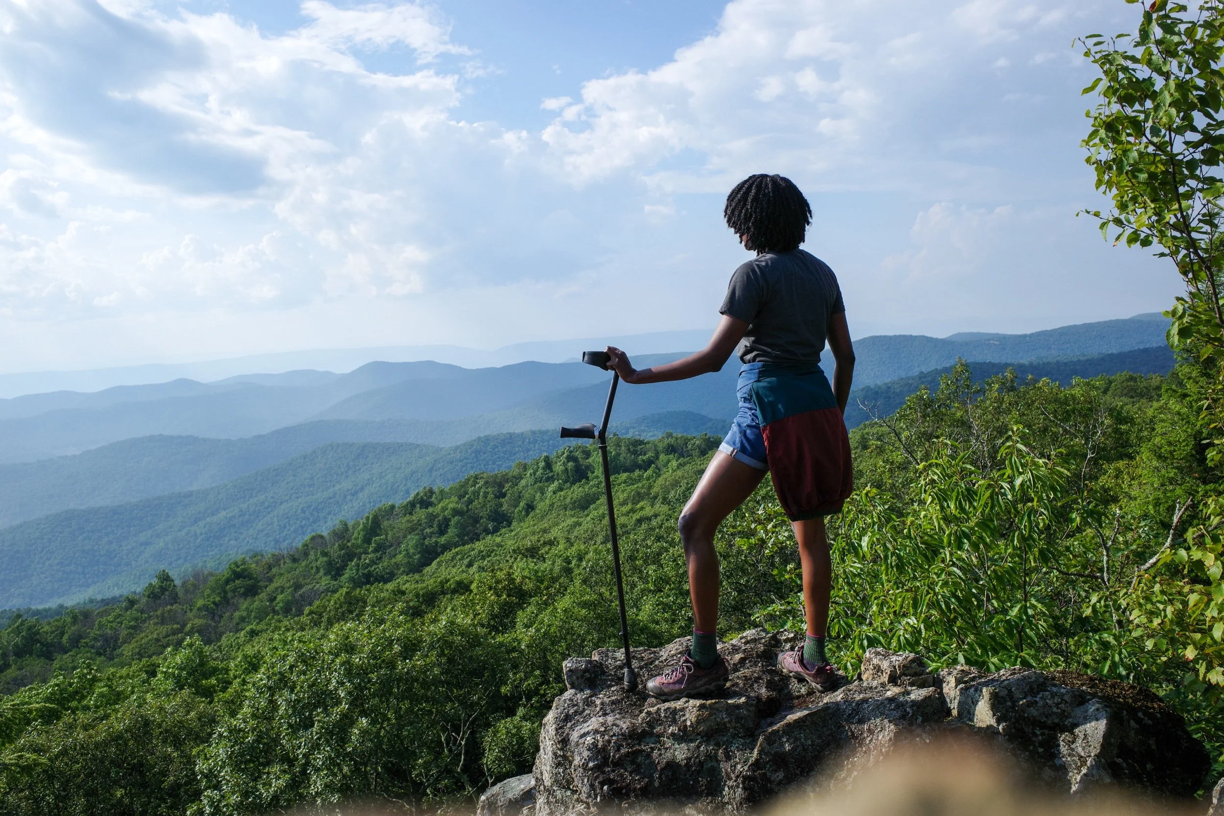
Photo of the author standing atop McAfee Knob with a gorgeous view of the Catawba valley below. Photo courtesy of a stranger I met on the trail.
Update 6/6/2024: Parking at the McAfee Knob trailhead is closed. To access the trail, please use alternative parking sites. Shuttle service is available Fri-Sun.
Do you live in the mid-Atlantic United States? Then you’ve probably heard of this Instagram worthy hike. McAfee Knob is a popular 8 mile hike along the Appalachian Trail (AT) in southwest VA. The well-known geographical feature rises almost 3,200 ft above the Catawba Valley and is said to be the most photographed spot along the AT, a 2,200 mile-long hiking trail that runs from Georgia to Maine. Here are some things to know before you go.
Whose Land Are You On?
McAfee Knob may have been re-named after a Scottish settler, however, it’s located on yeh is-WAH h’reh (Catawba), Yesan (Tutelo) and ᏣᎳᎫᏪᏘᏱ Tsalaguwetiyi (Cherokee, East) land.
Where Is This Hike Located?
McAfee Knob is located on the Appalachian Trail and is accessible via a trail head parking lot located off VA-311 in Salem, VA. The nearest major city is Roanoake, VA. Salem is roughly 3.5 hrs from Washington DC. and can be reached via I-66 W and I-81 S.

The Appalachian Trail intersects with the Fire Road 1.2 miles from McAfee Knob. Photo courtesy of author.
What Should I Bring?
Bring water, lots of it. This is a long hike and the humidity is definitely a factor. You should always bring water on every hike, with the goal of drinking 1 L/hr. Don’t wait until you start the hike to begin hydrating. I try to start the day prior, by consuming a mixture of water and Gatorade to make sure I’m peeing clear. I also avoid caffeine. Here’s what the American Hiking Society has to say about staying hydrated on your hike.
CamelBaks are great, because you can hydrate while you hike and keep your hands free. However, they’re really expensive. Make sure you stay hydrated, period!—whether that’s via hydration pack, reusable canteen or single use plastic. The view is beautiful, but making it back home safely is just as important, and the dangers of dehydration and heat stroke are real.
Bring layers. The temperature drops noticeably once you reach the final 1.2 mile stretch to the summit. I also bring a towel because I sweat buckets and I use hair product that I don’t like in my eyes.
Don’t forget snacks. My go to snacks are empanadas, trail mix with jellybeans, granola bars, and applesauce pouches.
Bring these just-in-case items: a head lamp with batteries, a cell phone with a portable battery pack and charging cord. Reception is actually pretty good along the trail. I always bring these items when I hike because I like to play it safe!
Check your vehicle. Do a quick visual inspection of your vehicle to make sure you can make it there and back safely. Check to make sure your blinkers, tailights, headlights, 4-way flashers and windshield wipers work. Grab a penny and check your tire tread and toss a plug kit in the trunk along with your spare tire and jack. Make sure your check oil, or engine light aren’t on. Make sure your gas tank is full. I know these seem like the basics but they’re basics we sometimes overlook. Trust me; there’s nothing worse than enjoying a beautiful day hike along that Appalachian Trail only to get stranded at the trail head afterwards. More on that later.
Bring a Gerber or multipurpose tool. I’ll explain why at the end of the article.

I returned in October 2020 to hike McAfee Knob and pose for this unmasked photo while we briefly had the trail to ourselves! Photo courtesy of Logan Williams
Parking Is Limited at the Trail head
The parking lot is located in Salem, VA north of where the Appalachian Trail crosses VA-311. Each time I’ve hiked this trail, I’ve arrived around 2 p.m. on a Saturday and waited anywhere from a few minutes to a half hour before I was able to find a spot. The later in the day you arrive, the easier it is to find parking. This parking lot fills up well before 8 a.m.! However, don’t arrive too late, or this 4-6 hr trip will quickly turn into a night hike. The parking lot is about 10 mins from I-81 and 5.5 miles up VA-311, heading up the mountain. If you block access to the parking lot with your vehicle, or park along VA-311, your car will be towed.
I’ve only hiked this trail on on the weekend. Like most trails, if you want to avoid crowds and not worry about parking, come during the week.
There Are Two Trails to the Overhang
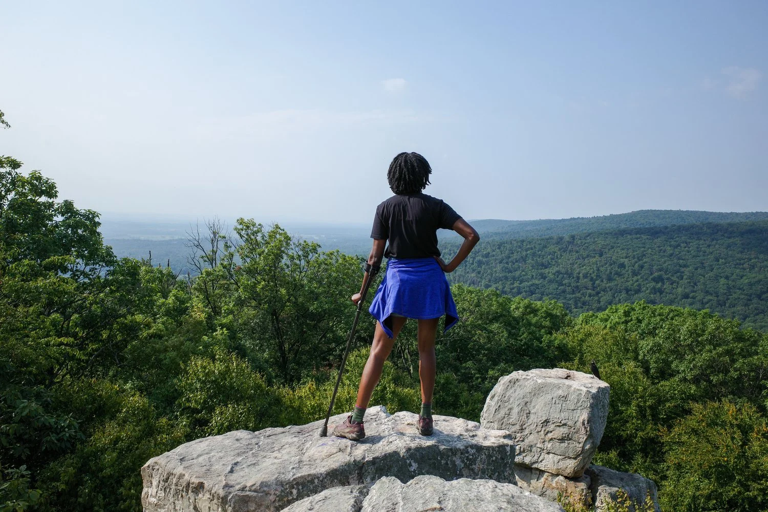
To start out, cross VA-311, and walk up a wooden and earthen staircase to the top of the ridge-line. There are pretty large rocks at the top so take your time. Within the first quarter mile or so, the trail forks. You can either go left to connect with the fire road, or down and to the right to continue along the Appalachian trail. I prefer the fire road simply because I use elbow crutches and I find that the fire road is easier to traverse.
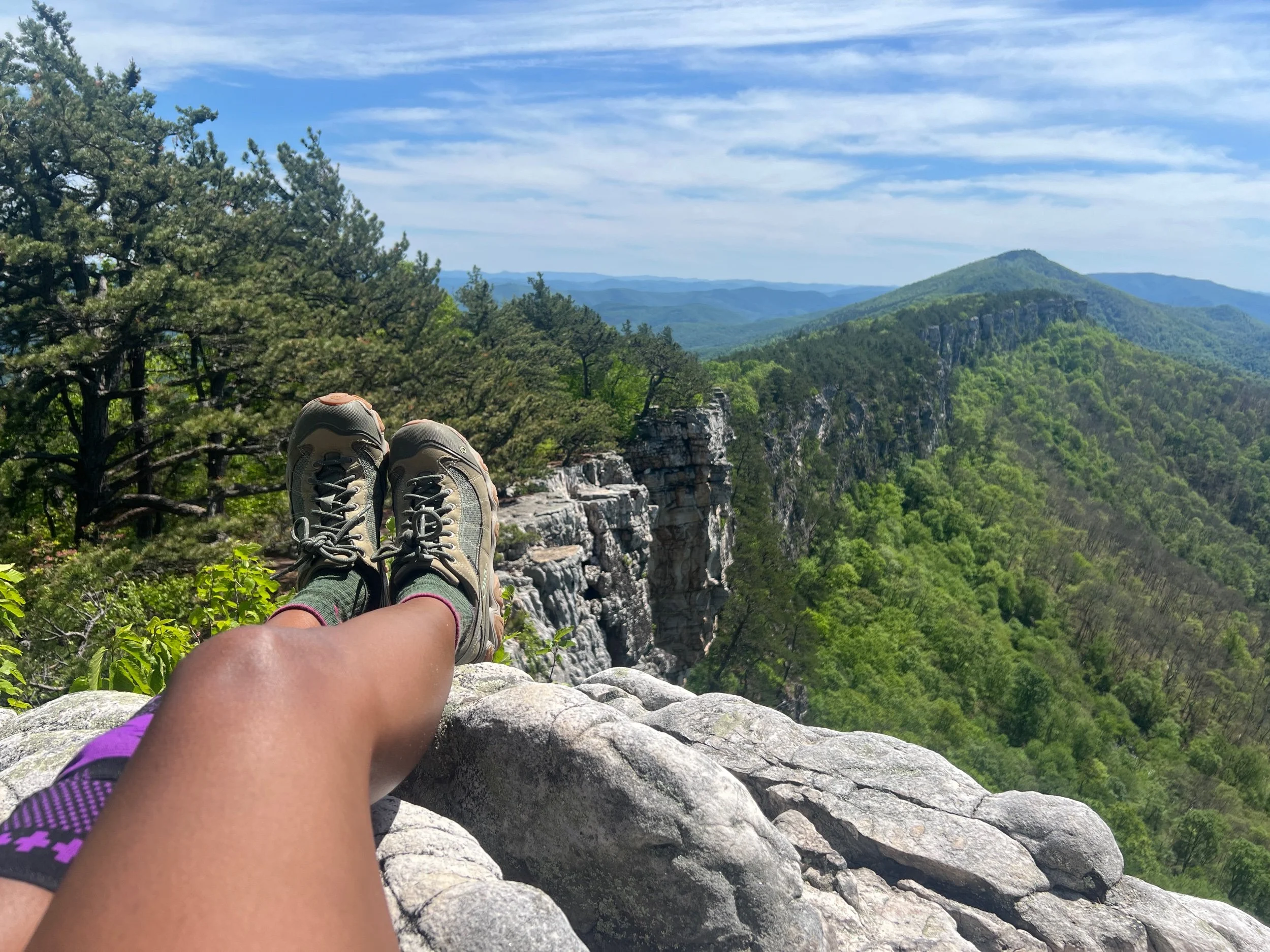
The fire road is compacted sand and dirt flanked by trees with a steep drop-off on either side. It can get super muddy or you may have to get your feet wet at some points - depending on how much it rained the previous day - but it’s pretty flat. There are a few gradual sloping hills before it eventually intersects once more with the Appalachian Trail. Also, the views of Catawba Valley below are picturesque.
Should you take the AT up to the summit, be prepared for a narrower slightly longer route with steeper terrain. Regardless of whether you take the AT or the Fire Road, at some point both intersect for the final 1.2 mile uphill trek to McAfee Knob.
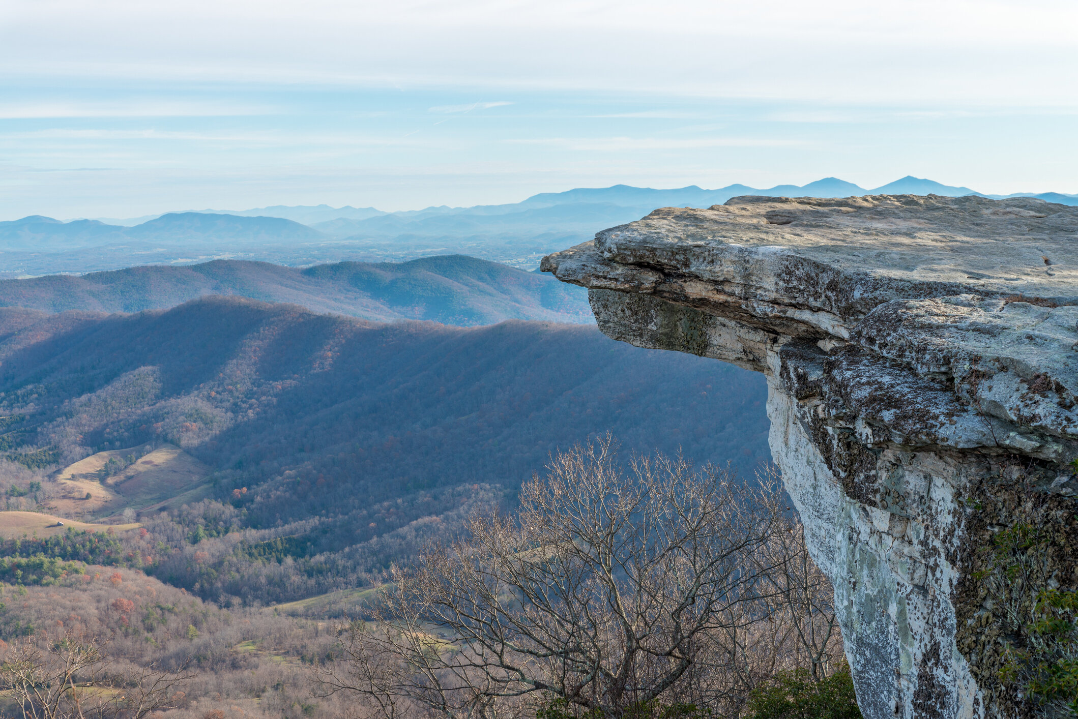
Autumn view of McAfee Knob. Getty Images
Crowds & Pups
This hike can be pretty crowded depending on the time of day and time of year. I’ve completed this hike on a summer weekend with soaring temps and humidity and the trail was pretty empty. So it really just depends. I am a mostly solo hiker, but I actually don’t mind a crowded trail head. I’ve also found that, because people hike at different paces and this is an 8 mile long round-trip, it doesn’t feel crowded on the trail. People tend not to hang out for too long at the Knob either, whether out of respect for other hikers trying to take photos, concerns about COVID or a desire to get started on the four miles back to their cars. So, the summit doesn’t feel super crowded either. I imagine this trail would feel a lot emptier in the winter, and a lot busier in the Fall.
Dogs are permitted on this hike but they must be leashed. For the most part, hikers seem to follow this rule. There are a few exceptions, but I noticed that strangers with unleashed dogs would generally leash their them once they caught sight of me, which I thought was courteous.
COVID-19
On a recent trip, I noticed that hikers were pretty evenly split between those wearing masks and those not wearing masks. For much of this trail, you can avoid coming within six feet of other hikers. The Fire Road is one example of this. There are some exceptions, like the final 1.2 mile push to the summit or, the entire hike, if you take the Appalachian Trail, where this is not possible. The Centers for Disease Control recommend wearing a mask “when hiking on trails that may be popular or crowded.” I also observed that quite a few people wore neck gaiters and bandanas.

A womxn and her fanny pack. Photo courtesy of a stranger I met along the trail.
Wildlife
The first time I hiked this trail, I was shocked when, as I approached the summit, a large shiny black snake slithered out of the brush and across the trail mere inches away from my trainers. It turned out to be a harmless rat snake, but it was still pretty thrilling! On the way down, each hiker making their way up towards the Knob passed along word that a bear cub had been sighted playing near the intersection of the Fire Road and the Appalachian Trail. So, on the same trip, I got to see my first rat snake and my first bear cub (outside of Shenandoah National Park). Other than the odd peacock on the Fire Road, that’s been it for exciting wildlife moments on this hike. Hopefully, yours are just as uneventful, if that’s your thing (it is mine). There are plenty of gnats, which is probably another good reason to wear a mask (and sunglasses).
Rest Areas
Unlike other trails that I hike more frequently, I noticed there aren’t many options if you want to sit down and rest along the Fire Road. In the beginning of the route, there are outcroppings of boulders. The farther you go, the fewer options you have. Once you reach the last 1.2 miles of the hike, which is single-track and uphill, there aren’t any rest areas until you get very close to the top.
Shelters & Camping
Camping is not permitted on McAfee Knob. People do it anyways, however, camping is restricted to official shelters and campsites to include Johns Spring Shelter and Catawba Mountain Shelter.
Car Trouble
So, I said I’d explain why you should bring a multipurpose tool or Gerber. Here’s why. On a recent trip to McAfee Knob, I finished the hike and returned to my vehicle only to find that my battery was dead. I mean dead dead. The next few hours were a comedy of errors. Immediately, the heavens opened up and it began to rain…sideways. I’m fortunate to have roadside assistance so I called my insurance company. They contacted a local towing company. An hour later, the tow truck driver arrived. The operator noticed that the terminals on my battery were completely loose. Unfortunately, neither of us had a 8 mm wrench. I grabbed my crutches and walked to the middle of the parking lot. I asked 10 different returning hikers if they had wrench that I could borrow. One hiker said they would check, and then drove off without making eye contact. The rest said no. It was not looking good.

After hanging out for awhile, the tow truck driver left to go ‘find a wrench.’ Five minutes later, I received a text from my insurance company informing me that the tow truck driver had been unable to locate me. Wait, what? I tried using the ride share apps on my phone, but no drivers were available. I considered walking, however, town was nine miles away.
At this point, I ditched my insurance and started calling different tow companies directly. However, it was getting late and on a Saturday. Hours had passed since I first laid eyes on my car after completing the 8-mile hike. Just when I was about to resign myself to sleeping in my car my luck finally changed! I finally was able to connect with an Uber driver, who just so happened to be a brother. I texted him to see if he had an 8 mm wrench. Within seconds, he texted back to say that he was going home to get it. Even with a bit of misdirection — turns out I needed a 10 mm wrench — within moments of pulling up, he reconnected my battery terminals and helped me get my battery charged so I could go home. Turns out, a Gerber is a decent substitute!
Lesson learned. I thought I had come prepared for my hike, but I hadn’t. Making sure your ride can get you there and back safely is just as important as the other details that go into planning a successful hike.
Overall, I love this hike because it’s close to home, accessible and has breathtaking scenic views at the top. For a summertime hike, it has just the right amount of people, and the length of the hike spaces out the crowds. I like the mix of day hikers of all skill levels as well as campers, section hikers and thru hikers. The fire road gives you the option of downgrading your difficulty level and greatly adds to the accessibility of this trail. It’s still an 8+ mile hike though, so make sure you come prepared.
Follow-Up

So I did go back and complete this hike during the third weekend in October - one of the busiest times of the years for leaf viewing. Here are the differences I found. The trail was a lot busier. Even though we began our hike in the late afternoon as usual, there was no parking left at the trailhead, so we took an Uber instead. The majority of people on the trail were not wearing masks, which carries a big risk for immunosuppressed hikers. The cooler weather made the hike a lot more tolerable but the high volume of traffic meant that slower hikers - like myself - were frequently standing aside to let faster hikers pass. At the top, we waited in line to take pictures - a minor inconvenience which didn’t stop us from enjoying the view and which also meant that other people could enjoy it too! Hikers naturally spaced out along the fire road. The congestion was mostly towards the top, once the fire road joined up with the Appalachian Trail. Overall, I still highly recommend this hike! During the Fall, weekdays are probably a better safer option, especially if you have mobility challenges. If you can’t safely accomplish your hike, don’t despair! The Blue Ridge Parkway with it’s beautiful Fall scenery, hiking and breath-taking overlooks is nearby. You have several options for accessing it. Don’t forget to check for route detours and closures first. There are also off-the-beaten-path state parks like Hungry Mother in nearby Marion, VA.
I’d love to hear from anyone who has hiked McAfee Knob in the winter. If that’s you, please leave a comment below!


I can either enjoy my life doing what I love, or sit at home worried about getting assaulted or worse. I choose to take common sense precautions, trust my gut, and hope for the best. But that doesn’t mean I’m never afraid.