
Rim to Rim - Grand Canyon National Park

My name is Ananth, and I live in Seattle, Washington. I work at a pet company called Chewy and volunteer with The Mountaineers, a nonprofit where I teach and lead mountaineering trips. I’m an Indian expat on a temporary work visa in the US, and I try to use every moment outside of work to explore the wild beauty of the Pacific Northwest—and to share those experiences with others.
I was born in Chennai, India, and spent my summers on my grandparents’ farm in a remote village, 200 miles from the city. Days were filled with labor—collecting firewood, tending to chores—but my imagination roamed far beyond. I dreamt of climbing mountains. My granddad, Kandasamy, was the greatest influence in my life. He always encouraged me to follow my dreams, even when they defied societal expectations. As long as I believed in something and pursued it, he and my grandmother supported me wholeheartedly. That’s how this journey really began.
Accident And The Life After
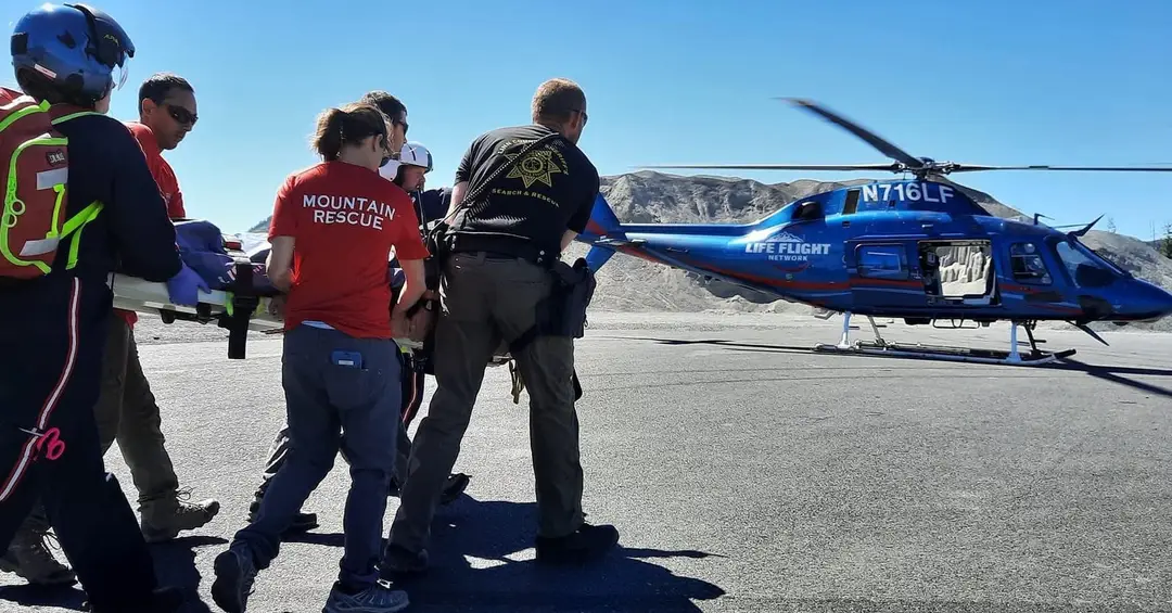
I started mountaineering in Washington in 2017 and have climbed over 600 mountains. But you never take anything for granted, as adventures always come with their own risks. In September 2022, a climbing accident changed everything. A loose rock gave way as I was climbing to the top of a volcano in Oregon, and I fell 100 feet down a rocky surface. I broke both legs at impact. I remember the fall vividly—it felt like 15 seconds of weightlessness before I slammed into a ledge, rocks still raining down on me. I thought I had died.
The Oregon National Guard airlifted me to safety. In the following months, I underwent five surgeries and had to relearn how to stand, how to walk and most importantly how to embrace life all over again. The journey was painful and humbling. I carry partial disabilities and have reduced mobility, but my community—and the mountains—brought me back. Returning to the outdoors was terrifying, filled with anxiety, but also incredibly healing. Nature has a way of quieting your fears.
Why The Grand Canyon?
After months of rehab and slowly regaining strength, I began dreaming of bigger objectives again. I knew I wasn’t the same person, but that didn’t mean I had to stop living fully.
I’d always found comfort in the familiar landscapes of Washington. Traveling somewhere new was daunting. But when we got a permit for Mt. Whitney, I felt ready to challenge myself. Unfortunately, nature had other plans. A storm rolled in with 60mph gusts and heavy snow. We had to cancel. At the last minute, we pivoted and chose to attempt a Rim-to-Rim hike in the Grand Canyon instead.
How I Prepared For The Trip
I didn’t train specifically for the Grand Canyon, but I’m lucky to live in Washington where mountains are accessible. Every week, I went hiking or climbed stairs around Seattle to build endurance. If you're training for a big hike, here’s what I recommend:
Walk long distances: start with 5 miles, then 10, and build up.
Do stairs whenever you can.
Use a treadmill on an incline for extended periods.
Focus on endurance over speed.
To my fellow farmers reading this: it’s a bit like working the paddy fields on a hot day. Stomping through wet mud before planting rice seedlings—it’s exhausting, but it builds strength and brings joy. Hiking is much the same.
The Trip Itself “From Mount Whitney to Plan B”

On the flight from Seattle to LasVegas with views of St Helens. Photo by Ananth Maniam (ஆனந்த் மணியம்).
Originally, we were supposed to summit Mount Whitney, but with nasty gusts and stormy weather on the forecast, we pulled the plug. With flights already booked, we pivoted fast. A few frantic searches later, the Grand Canyon rose to the top one of those hikes we’d all wanted to do “someday.” Well, someday became Saturday.
We flew into Las Vegas, rented cars, and road-tripped into Arizona.
We crashed for the night in Williams, about an hour from the South Rim, so we could catch some sleep before the early start. Lucky for us, the North Rim had just opened for the season, meaning we didn’t have to do a soul-crushing round trip—we booked a last-minute shuttle to get us back to the South Rim after the hike.
Trip Stats
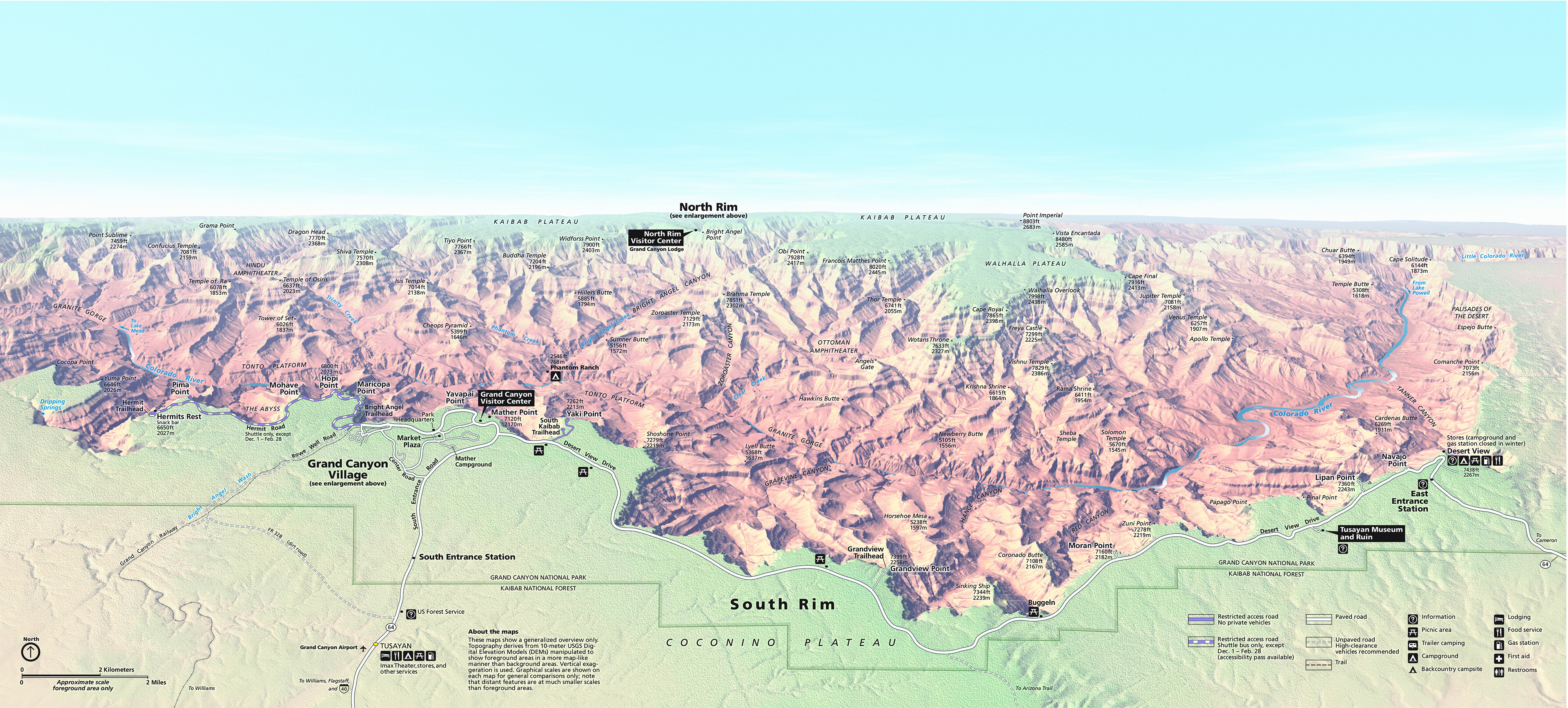
Route: South Kaibab to North Kaibab
Distance: ~21 miles
Total Elevation Gain: ~6,600 ft
Time: ~11.5 hours
Start Time: 4:30 AM
End Time: Just before 4 PM
Best Lemonade Ever: Confirmed at Phantom Ranch
Wildlife Sightings: One snake, many squirrels, lots of mules, and a bunch of tired but happy humans
Things to know more about Grand Canyon from the National Park service and Wikipedia:
Panorama of the Grand Canyon. Credit: National Park Service

Geology of the Grand Canyon

South Rim village of the Grand Canyon

Ranger guide and map of the Grand Canyon
Rim-to-Rim Route Decision Chart

Using all the thoughts, we decided South to North is the best way to go for us!
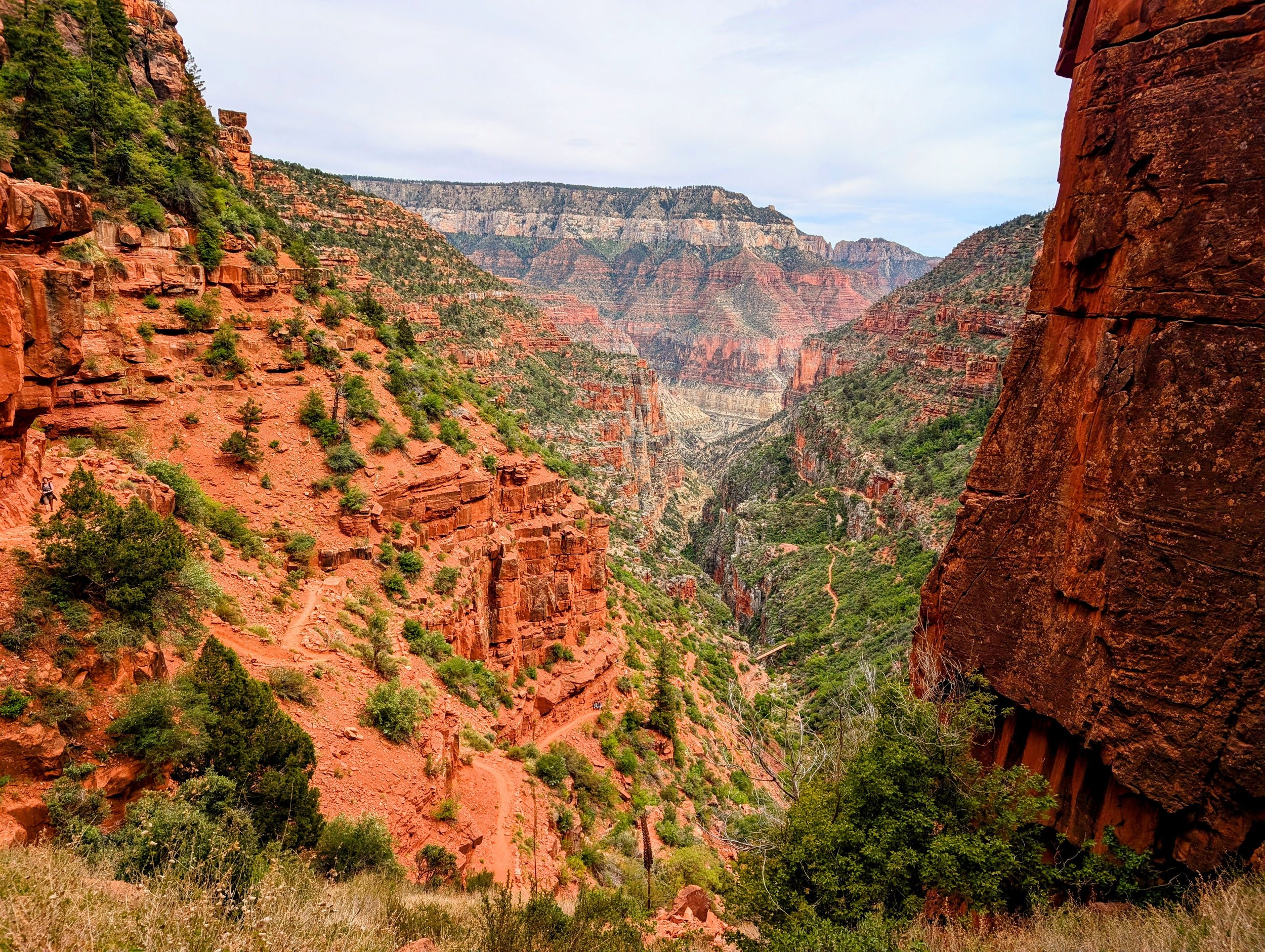
The Hike Begins: South Rim to Phantom Ranch
We kicked off from the South Kaibab Trailhead at 4:30 AM, in the dark, our headlamps lighting the way. The morning was cool—perfect hiking weather—and the sky was just starting to hint at the sunrise. The trail drops fast, and within minutes we weaved our way down steep switchbacks, passing early-bird day hikers and the occasional runner already charging uphill.

Start at the South Kaibab trail of the Grand Canyon

Twilight before sunrise as we start
One thing you quickly realize about the South Kaibab is that it wastes no time getting serious. It’s steep, exposed, and dry—there’s no water until you hit the bottom, so we loaded up in advance. The first real viewpoint was Ooh Aah Point, about a mile in, and it lived up to the name. The canyon stretched out in every direction, glowing in the early light. From there, the crowds started to thin, and we found our rhythm.

Views as we get down to Ooh aah Point

Sunrise at 5.30 AM as we are dropping down in the well maintained trail

The trail was well maintained and wide. We saw a lot of runners going along, plus a lot of day hikers
We passed Cedar Ridge and stopped briefly to take in the panorama—and breathe. There are toilets there but no water. The descent continued, revealing layer after layer of the canyon’s rock history, each stratum a different texture and color. Somewhere after Skeleton Point, the canyon felt like it had swallowed us whole. It’s humbling, being that small in something that big.

At Cedar ridge - the trail markings were great - you can see the run rising from the back

Some of the day hikers turned around at Cedar ridge after sunrise and the others started trudging slowly down

Views of the carved earth formed over millions of years and the vast expanse of the canyons
The trail zig-zagged down through loose, muddy sections (thanks to spring runoff), winding closer to the Colorado River far below. Eventually, we hit the Tip-Off, a small rest area perched on the Tonto Platform with a composting toilet and a bit of shade. From here, the river finally came into view, shimmering in the sunlight—a mental milestone, even though we still had a ways to go.

Views of the carved earth formed over millions of years and the vast expanse of the canyons

After a while the trail turned into dusty, dark red soil- which zig zagged through to the next stopping point

Finally found my matching rock

Stepped off to the side of the trail to enjoy a quick break before we started again
The final descent before the river is both brutal and beautiful. The trail narrows, carved into ancient stone, and passes through a short tunnel just before you hit Black Bridge—a suspension bridge built in 1928 that spans the Colorado. Crossing it felt like walking into another world.
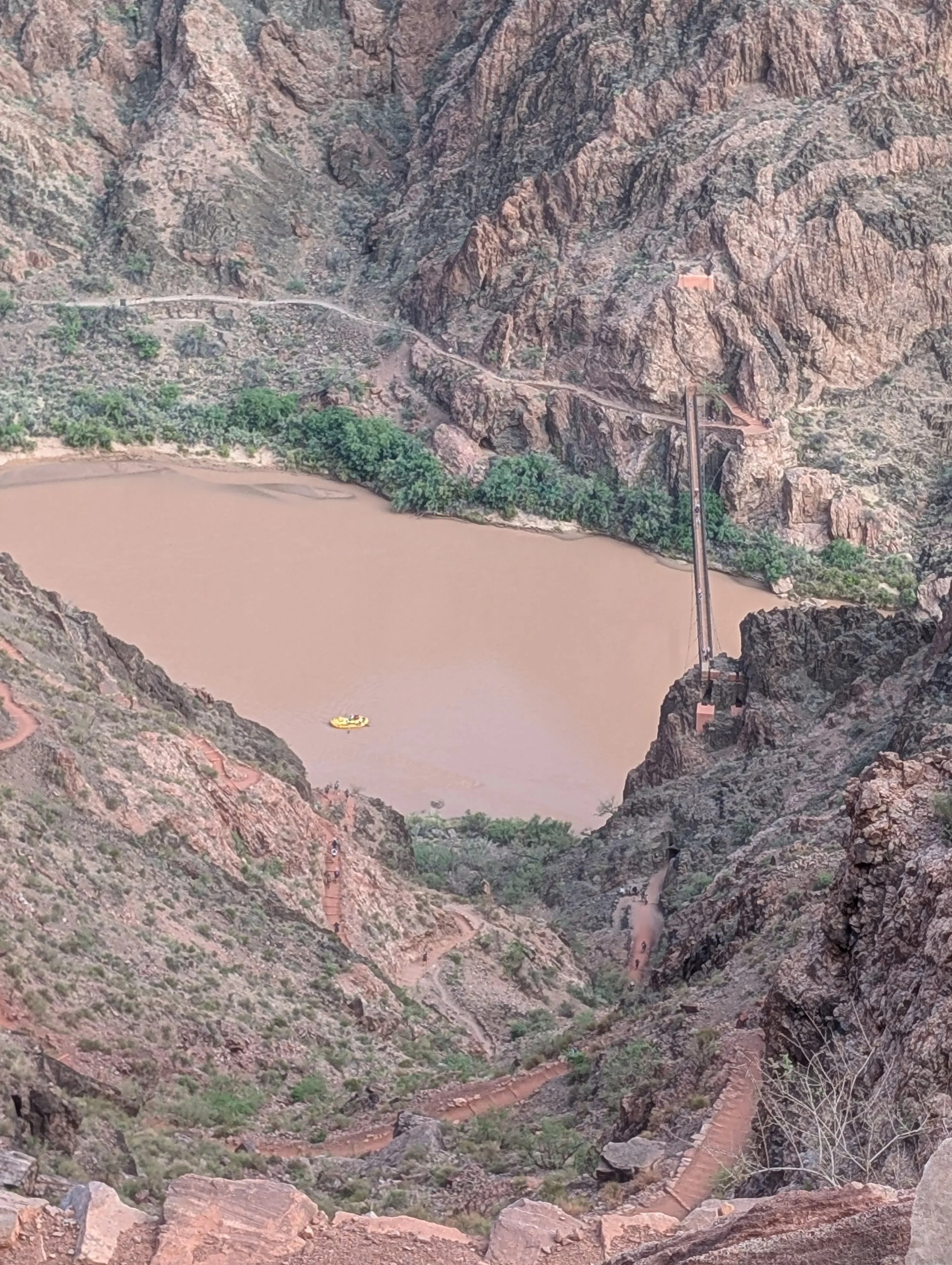
First views of the Black bridge, but we also saw people pack rafting the Colarado river, which was super fun to notice
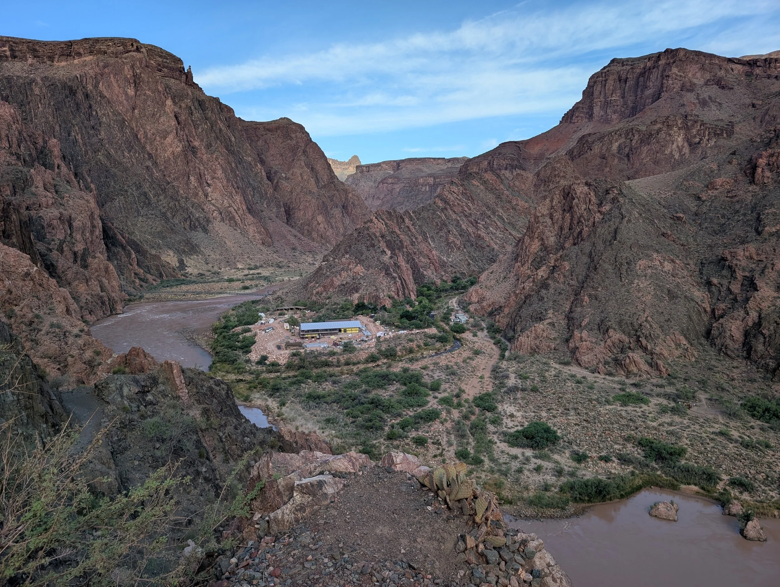
The construction happening at Bright Angel campground

Clear views of the tunnel and the historic blackbridge

Runners going through the blackbridge as we exit the tunnel
Don’t forget to stop by and learn about the native settlements who lived here long before and their way of life at the Pueblo site

The combined family living at the Pueblo site

On the other side, we found the Bright Angel Campground, still under construction as crews worked to rebuild the water pipeline that runs through the canyon. Just a few minutes up the trail was Phantom Ranch, where we took a well-earned break.

There were water spots from here on - all the way to the top of North rim. So one doesnt have to worry about carrying water for 21 miles of hiking

First Rattlesnake sighting for me!
By then it was around 9:30 AM—five hours and nearly 7.5 miles into our day. We grabbed cold lemonade at the canteen at Phantom Ranch (totally lives up to the hype), wrote some postcards to be sent out by mule, and sat down for a bit, chatting with other hikers and soaking our feet in the cool creek nearby. We even saw a snake slither off into the underbrush—classic canyon moment.

First views of the Ranger station and the Phantom Ranch

First views of Phantom Ranch
After we wrote post cards (which are carried by mules) we got lemonade and walked out. The Ranch is stocked with snacks, coffee, beverages and also games and AC. If you are lucky and have a reservation to stay in the lodging (using the lottery method), the lodges are powered with AC and you can enjoy the views better


Stopped at the Ranger station and got a stamp and marked our notes there. No summit register- no worries!
Everything about that stretch of trail—from the geology to the sunrise to the surreal little outpost at Phantom Ranch—made it feel like we were moving through time as much as space.
Phantom Ranch to the North Rim: The Real Work Begins
Leaving Phantom Ranch, we refilled our water, tightened our packs, and mentally geared up for what we all knew was going to be a long, slow climb out. From here, it was about 13.5 miles and over 6,000 feet of gain to the North Rim—and most of that climbing would hit us in the final stretch.

The trail north starts deceptively gentle. We followed the North Kaibab Trail along Bright Angel Creek, through a section known as “The Box.” It's a narrow, winding slot canyon carved into dark Vishnu Schist that’s over 1.7 billion years old. Pretty mind-blowing when you think about it. The canyon walls towered over us, and even in the morning, the heat started to creep in. The air down there gets thick and still, like it’s trying to trap every bit of sunlight.


Deep canyon walls, it started getting hot - we could see people slowing up in this exposed sections of trail in the heat

Vast openness of the canyons - we were stopping at every possible shade to rest and recover
We crossed the creek on a series of sturdy bridges—seven crossings in total, down from the original 94(!) before the trail was reengineered. These miles are some of the most scenic and meditative. The sound of water, the play of light on rock, the occasional splash to cool off—it was a beautiful stretch and a much-needed mental reset.

Eventually the canyon widened, the sun got stronger, and we approached Ribbon Falls, which you can detour to via a short creek crossing. We didn’t make the side trip this time (day-hike mode = focus), but if you’re not pressed for time, it’s a magical little waterfall tucked in a lush alcove.

Ribbon falls at the center (look for light green in the dark red)
We kept moving and passed Cottonwood Campground around mile 14, where we saw more hikers refueling and regrouping. Some were struggling—we shared electrolyte chews, snacks, and encouragement. That’s one of the best parts of long hikes like this: the trail community really shows up when people need it.


Maps showing for NorthRim hikers how much they've come down and the vice versa for us

So glad to see fish restoration in the Colarado River

We had clouds rolling and wind - so the temps read about 84F- but felt like 95F with the heat and humidity


After Cottonwood, the trail tilted up more noticeably. The gradual incline became a sustained climb, and by the time we reached Manzanita Rest Area (formerly the Pumphouse), we were officially in “climb-out mode.” This is where things get serious.

The crumbling rocks were a reminder that we were starting to gain elevation again, as this was a reminder of what we saw in the south rim as we descended earlier in the day

From Manzanita to the North Rim, it's only 5.5 miles—but it gains over 4,000 feet, and the terrain doesn’t cut you any slack. We passed Roaring Springs, the water source for both rims, and started up the tight switchbacks carved right into the canyon walls. Some parts of the trail are literally blasted into sheer cliffs. It's stunning, and a little intimidating, but also impressively engineered. When you’re gasping for breath, it’s easy to forget you’re walking through a world-class geologic marvel.


The trails here were carved into the walls and blasted to make sections work- very well engineered
We crossed Redwall Bridge, climbed through the Supai Tunnel, and finally entered cooler air and pine forest. The change in environment was dramatic—red rock gave way to green, cactus to conifers. We’d gone from desert to alpine in a matter of hours.

Supai Tunnel


Red rocks were giving way to greener pastures and desert flowers
That final mile and a half was a slog. Legs heavy, packs sagging, the sun dipping lower. But eventually, we heard voices, saw people milling around the North Kaibab Trailhead, and realized we’d made it.
North Rim Arrival: Tired Legs, Full Hearts


We rolled into the North Rim just before 4 PM. Not going to lie—there were some high fives, a few groans, and a shared look of “what the hell did we just do?”

A view of Ponderosa pine was a reminder of home back in Washington state

We were dusty, sunburnt, and running low on snacks, but crossing the canyon in a day left us buzzing. It’s hard to explain how surreal it feels to stand on the opposite rim from where you started that morning. Everything about the canyon is overwhelming—in size, beauty, and effort—and walking across it just makes you feel small and strong at the same time.
Other Options for Planning a Rim-to-Rim
If you're considering your own Grand Canyon adventure, here are some options:
Routes:
South Rim to North Rim (what we did): Steeper descent at the start, longer climb out.
North Rim to South Rim: Slightly longer descent, but often preferred for pacing.
Trip Style:
One-Day Hike: Challenging and strenuous. Only attempt if well-trained.
Multi-Day Backpacking: Break the trip up with an overnight at Phantom Ranch or Bright Angel Campground.
Rim-to-Rim-to-Rim: For ultra-runners and masochists alike.
Logistics:
Permits are required for overnight trips.
Consider shuttle services if you're not doing an out-and-back.
Watch out for extreme temperatures—spring and fall are best.
Final Thoughts
The Rim-to-Rim hike was more than just a physical achievement. For me, it marked a return to life, to movement, and to purpose. It reminded me that even when life knocks you down—hard—you can find a way back. Step by step, mile by mile.
Whether you’re dreaming of your first canyon hike or recovering from a personal setback, I hope my story encourages you to take that next step.
Adventure is always out there, waiting.